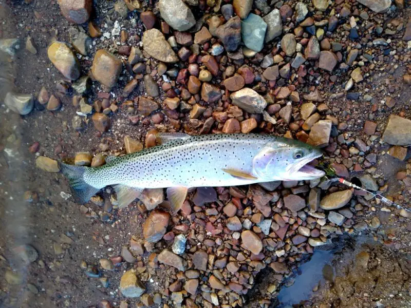
Bonneville Cutthroat Trout is one of the four subspecies you have to catch to complete the Utah Cutthroat Slam. The following article will inform you on where to find Bonneville Cutthroat Trout in Utah.
Bonneville Cutthroat Trout’s historic range is the headwater drainages of Lake Bonneville, where their ancestors were stranded after the Lake went away. Also, see Bonneville Cutthroat Trout in Nevada and Where are the Bonneville Cutthroat Trout in Wyoming
The seven sections of the state of Utah where you can find Bonneville Cutthroat Trout are listed below.
- The Deep Creek Mountains
- Jordan River Drainage
- Southern Wasatch Front high mountain lakes
- Sevier River Drainage
- Spanish Fork River Drainage
- Weber River Drainage
- Provo River Drainage
Bonneville Cutthroat Trout are back from the verge of extinction. Back in the day, for a period of around forty years, up until the early 1970s, aquatic biologists had all but officially declared that they were extinct. Around 1974 a small remnant population of them was discovered in western Utah. This made the announcement of their complete departure from their native environment a bit premature. Subsequent populations were also found. State and federal fisheries officials were able to turn the tide on this almost extinction and recover the Bonneville Cutthroat trout to a decent-sized portion of its former habitat.
Today, there are in the neighborhood 202 Bonneville cutthroat trout populations swimming in around 2,728 stream miles in 21 watersheds in Utah, Idaho, Nevada, and Wyoming. Utah has its share of fishable Bonneville Cutthroat Trout waters. I’ve compiled a partial list along with whatever details I could find on each area.
The Deep Creek Mountains
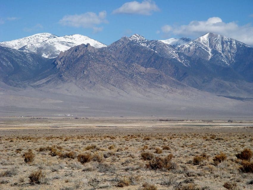
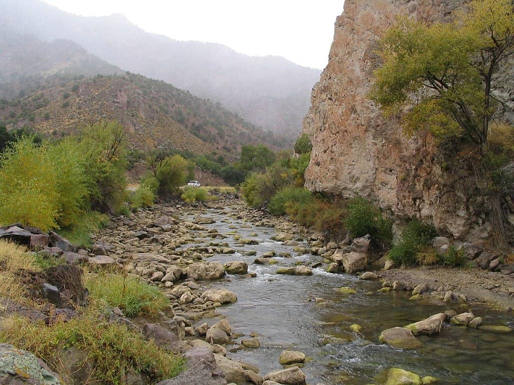
If you’re looking to catch Bonneville Cutthroat Trout and you’re not into fighting with crowds of other fishermen, then you might look into fishing the drainages on the eastern slope of the Deep Creek Mountains in west-central Utah.
The fish are not huge. A twelve incher is a large one. The solitude is great, though, and the scenery is spectacular
A desert mountain range
The Deep Creek Mountains are truly unique. They rise up like an island in a sea of the desert to over 12,000 feet above sea level on two of their peaks. There are groves of pine and aspen on their slopes, and in addition to having Bonneville Cutthroat Trout in their waters, they are home to deer, elk, and bighorn sheep. They are 32-miles long and anywhere from 3 to 15-miles-wide and are located in west-central Utah, on the Utah-Nevada state line approximately 55 miles south of Wendover.
Once believed to be extinct, Bonneville Cutthroat Trout were rediscovered in the Deep Creek Mountains.
There was a time when Bonneville Cutthroat Trout were thought to be extinct. In 1974 biologists discovered a population of them in Birch Creek on the Deep Creek mountains’ eastern slope. An additional discovery of a population of Bonnevilles was made in Trout Creek, also on the east side of the Deep Creeks. Subsequent small populations were found around Utah, and from these, the recovery of Bonneville Cutthroat Trout species was implemented.
From the Utah Cutthroat Slam website, I obtained the following list of streams in the Deep Creek mountains with fishable populations of Bonneville cutthroat trout.
- Trout Creek
- North Fork of Birch Creek
- Granite Creek
- Red Cedar Creek
- Tom’s Creek
- Indian Farm Creek
- Basin Creek
How to get there
Granite Creek is accessible by a four-wheel drive type road that follows the creek along the canyon bottom. Indian Farm Creek also has a short 4×4 two-track road. Trout Creek has a decent trail along with it.
You can easily drive to the CCC Camp near Calao. Tom’s Creek flows right past the camp, and there are Bonneville Cutthroat Trout to be caught in the area.
Access to Red Cedar Creek is 11 1/2 miles out of Callao, Utah
Access to the North Fork of Birch Creek is 23.1 miles out of Ibahpah, Utah
It appears that you’ll have to do some hiking to get to Basin Creek. Click for a map.
This country is very remote. You should not attempt to go here without a four-wheel-drive vehicle, a good spare tire or two, ample fuel, and ample provisions. There are no available services.
The following directions are copied from The Bureau of Land Management’s web page on the Deep Creek Mountains.
More about the area
“Access to Ibapah and Callao’s towns on the approach to the Deep Creeks is over pavement and maintained dirt roads. These are accessible by 2WD vehicles most of the year, although 4WD is always recommended.
The easiest approach to the Deeps is via Interstate 80 and Wendover. Drive south from Wendover toward the town of Ibapah and turn off on the Pony Express road to get to Callao, and access the Deep Creeks WSA from the east side. An alternative option is to travel westbound from the Wasatch Front on the Pony Express Road Past Fish Springs to Callao, but this route is over gravel roads with no services or fuel available.
Access to the Deep Creek WSA boundary is generally on 4WD off-highway vehicle routes that are dusty, rocky, rugged, and sometimes impassable during inclement weather. Some routes are suitable for full-size vehicles, but many others are for ATVs, motorcycles, or side-by-sides only. Check conditions with the local BLM office before attempting a given route for the first time.”
Jordan River Drainage
Little Dell Reservoir
Little Dell Reservoir is a brood source for the Utah Division of Wildlife Resources. They collect genetically pure Bonneville Cutthroat Trout eggs here to transplant around the state.
Regulations
The only fishing allowed at Little Dell is catch and release. Additionally, artificial lures and flies are the only legal tackle. One more no at Little Dell is motorized boats.
Big Trout
On the bright side, you have a better than average chance of catching a large Bonneville cutthroat here with fish weighing up to 5 pounds.
Little Dell Reservoir is approximately 14 miles from South Salt Lake. Take I 80 east up Parley’s Canyon, then take exit 134 for Route 65 north, then take route 65 north towards East Canyon.
Mill Creek
Native Bonneville Cutthroat Trout are once again swimming in Mill Creek. See https://www.youtube.com/watch?v=pOAOaG_cOcU
Parley’s Canyon
Parley’s Canyon Creek runs alongside interstate 80 in Parley’s Canyon. This is a narrow brushy stream. I found this video on Youtube. https://www.youtube.com/watch?v=_Nr4m8Cf6do
Lambs Canyon Creek is a tributary of Parleys Creek, Which is another narrow Brushy stream.
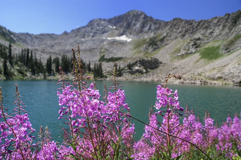
Southern Wasatch Front High Mountain Lakes
Red Pine Lakes and White Pine Lake
Upper and Lower Red Pine Lakes and White Pine Lake are accessible from the White Pine Trailhead, located approximately 5 ½ miles up Cottonwood Canyon.
To reach White Pine Lake just follow the trail signs.
To get to Lower Red Pine Lake, there is a signed fork in the trail; the trail leads out of White Pine Canyon and up to Lower Red Pine Lake. The trail is well maintained and easy to follow. To reach Upper Red Pine Lake locate Lower Red Pine Lake’s inlet and follow it to the upper lake.
Twin Lakes Reservoir
Twin Lakes is near the resort community of Brighton. Brighton is approximately 14 miles up Big Cottonwood Canyon from Salt Lake City. At Brighton, go to the Silver Lake Visitor Center parking lot at 8073 Big Cottonwood Canyon Rd. From there, locate the Silver Lake trailhead. Follow the Silver Lake trail to the right along the lakeshore. At the far end of the lake, you’ll come to a trail junction. Take the right-hand fork towards Twin Lakes and Lake Solitude. Not far from here, you’ll come to a second junction. This time take a left and follow the trail on to Twin Lakes.
Upper Bell’s Canyon Reservoir
To get to the upper Bell’s Canyon reservoir, you’ll start at the Bell Canyon trailhead located just south of 10180 South Wasatch Blvd. above Sandy. It’s just over a quarter mile to the lower lake. It should take you around twenty minutes to get there. You’ll go right on past the first lake. Around 4 ½ miles in, you’ll come to a waterfall. If you want to make it to the upper reservoir, continue up the trail, though. You’ve got another approximately three-hour hike to go. The trail becomes quite steep, and you’ll be going over a boulder field but persevere, and you’ll make it.
Sevier River
Manning Meadow Reservoir
Manning Meadow Reservoir is a little over 19.4 miles from Monroe, Utah. The Utah Division of Wildlife Resources uses Manning Meadow Reservoir as a brooding lake for genetically pure Bonneville Cutthroat Trout. There is a 2 fish limit with tackle being limited to artificial lures and flies only.
Barney Reservoir
Barney Reservoir is around 21 miles from Monroe, Utah. It’s planted with Bonneville Cutthroat Trout and Tiger Trout, which are sterile.
Neither Manning Meadow Reservoir nor Barney Reservoir has an improved campground. The Forest Service allows Primitive camping at both sites, though. Both Manning Meadow Reservoir and Barney Reservoir sit on tributary streams of Manning Creek.
Manning Creek
The UDWR manages Manning Creek for native Bonneville Cutthroat Trout. The creek comes down off the side of Monroe Mountain just to the south of the town of Marysvale. Stream access is on a dirt road to the mouth of the canyon, approximately ten miles out of Marysvale. A hiking trail parallels the creek for approximately eight miles up the canyon from the end of the road.
Clear Creek
Clear Creek is one of the largest tributaries of the Sevier River. It flows right along Interstate 70 through Fremont Indian State Park, which is around 26 miles to the southwest of Richfield, Utah. The Utah Division of Wildlife Resources has restored native Bonneville Cutthroat Trout to Clear Creek and its tributaries. This encompasses around 65 miles of stream.
Other Sevier River headwaters and tributaries
The following waters get stocked annually with Bonneville Cutthroat Trout. According to the Utah Division of Wildlife Resources website. They may have other trout species in them as well, though. East Fork Sevier River in Black Canyon, upper Sevier River, and Asay Creek near Hatch Pine Lake, Yankee Meadow Reservoir, Upper Enterprise Reservoir, and all three Kent’s Lakes on Beaver Mountain.
Spanish Fork River
Diamond Fork River
The Diamond Fork is a tributary of the Spanish Fork River. Its tributary streams, Shinglemill, Chase, and Halls Fork creeks. The point where Shinglemill and Chase Creeks come together is approximately 28 miles out of Spanish Fork. They join Halls Fork downstream a little way to form the Diamond Fork River.
Right Fork of Clear Creek
Clear Creek is a tributary of Soldier Creek, which is a tributary of the Spanish Fork River. Clear Creek Flows along Skyline Drive. The entrance to Skyline Drive is at Tucker, Utah, 7 miles to the West of Soldier Summit Utah on US-6.
The Right Fork of Clear Creek is a short hike upstream from where the route of Clear Creek diverges from Skyline Drive.
Weber River Drainage
For the Utah Cutthroat Slam
The Weber River is not in the Bear River drainage. However, since native Cutthroats from the Weber River drainage historically mixed with those of the Bear River, any Bonneville Cutthroat Trout caught from the Weber drainage can count as either a Bonneville Cutthroat or a Bear River Cutthroat on the Utah Cutthroat Slam. However, if you count a fish caught in the Weber drainage as a Bear River Cutthroat, you must go to a different drainage to hunt for your Bonneville Cutthroat or vice versa.
Weber River
The Utah Division of Wildlife Resources Manages the Weber River and its’ tributaries from the town of Oakley, UT upstream to its headwaters and from its confluence with the Ogden River upstream to Echo Dam for Bonneville/Bear River cutthroat trout.
Weber River Tributaries
The Utah Division of Wildlife Resources manages the Following Weber River tributaries for Bonneville/Bear River cutthroat trout.
Provo River
Catching a Cutthroat Trout from the following waters in the Provo River drainage qualifies for the Bonneville Cutthroat spot on your Utah Cutthroat Slam. Click on the names to access a map of each area.
South Fork of the Provo River headwaters
Access to Bench Creek is 8.6 miles out of Francis, Utah.
South Fork of Little Deer Creek
The South Fork of little Deer Creek is a small brush choked stream. This presents challenges to fishing it.
Good Luck in your pursuit of Bonneville Cutthroat Trout in Utah
Make the decision to fish in some places you’ve never been to before. The Deep Creek Mountains are on my personal bucket list.
Fishing after all is an excuse to get out into the outdoors and explore.
Recent Articles
The least weasel is the world's smallest carnivore. This little predator is also the smallest member of the Mustelidae or weasel family. They are around 320 times smaller than wolverines,...
The only venomous snakes in Washington State are Northern Pacific Rattlesnakes. The Northern Pacific Rattlesnake (Crotalus oreganus oreganus) is a sub-species of the Western Rattlesnake. Anyone...