Yellowstone Cutthroat Trout is one of the Four sub-species included in the Wyoming Cut- Slam. This article will tell you where to find Yellowstone Cutthroat Trout in the state of Wyoming.
The Wyoming Cut-Slam was the idea of Wyoming Fisheries Biologist Ron Remmick, with the purpose to quote, “encourage anglers to learn about Wyoming’s cutthroat trout…and develop an appreciation for the habitat needs and management programs necessary to maintain these species”.
To participate in the Slam, download an application from the Wyoming Game and Fish Department website, found here.
Next, as you catch each of the four sub-species, you’ll need to document it with a clear photo and the time and date of your catch.
There is a real appreciation and a movement among some anglers to fish for species in their native environment that their ancestors were swimming in long before the conquest and settlement of the territory now encompassing the United States. This is true, particularly in the Western United States. As European American settlers colonized, the west native trout species didn’t necessarily do very well under the new civilization’s circumstances. Today Native Cutthroat Trout only inhabit a fraction of their former territory. In fact, Yellowstone Cutthroat Trout only inhabit around 40% of their former range.
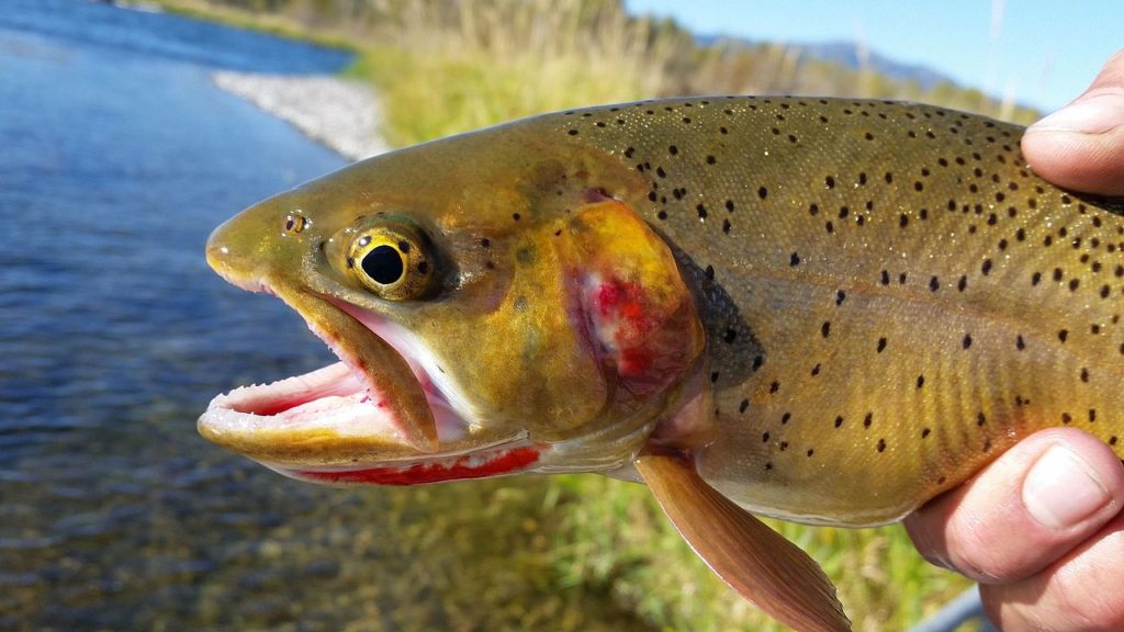
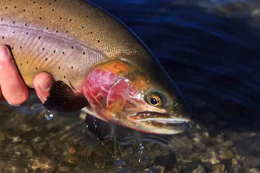
Yellowstone Cutthroat Trout Characteristics
On average, Yellowstone Cutthroat Trout is the least colorful of the fourteen-cutthroat subspecies. From the Wyoming Cut slam website, “The Yellowstone Cutthroat is typically olive green to brown on the dorsal (back) side with yellowish-brown to silver on the lateral (sides) surface. Spotting in all cutthroat is variable among populations and individuals. That said, a “typical” Yellowstone Cutthroat would have dark black spots with spots concentrated toward the tail and few, if any, spots on the head.”
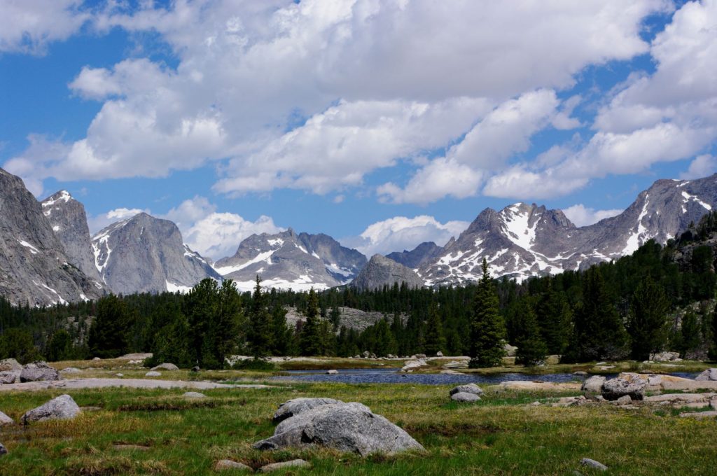
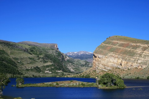
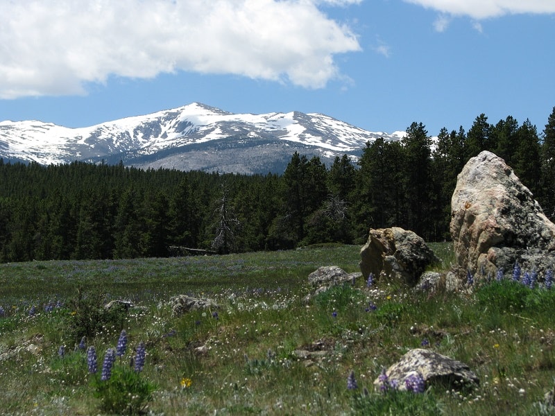
Wind River Mountains
The North Fork of the Popo Agie River
The North Fork of the Popo Agie River originates in the Popo Agie Wilderness on the east slopes of the Wind River Mountains west of Lander Wyoming at Lonesome Lake. It runs 43 miles to join the Middle Fork of the Popo Agie near Lander. The North Fork of the Popo Agie and Lonesome Lake features Yellowstone Cutthroat Trout.
High Meadow Lake and Cliff Lake are also headwaters of the North Fork of the Popo Agie that hold Yellowstone Cutthroat Trout. High meadow Creek drains High Meadow Lake and is a tributary stream of the North Fork of the Popo Agie containing Yellowstone Cutthroat Trout.
The Big Sandy entrance to the Popo Agie Wilderness provides the shortest route to Lonesome Lake at around 9 miles. The Big Sandy entrance is located approximately halfway between Lander Wyoming and Farson Wyoming.
Wind River Reservation
The Following waters, which are listed on the Wyoming Cutt Slam URL as holding Yellowstone Cutthroat Trout, are found within the boundaries of the Wind River Reservation of the Eastern Shoshone and Northern Arapaho tribes. A tribal fishing permit will be required here. You can contact the Tribal Fish and Game office at 1-307-332-7207 for details on fishing and camping permit fees, season duration, and other pertinent details.
Washakie Reservoir
Washakie Reservoir is an impoundment used primarily to store irrigation water on the South Fork of the Little Wind River. Its located around 8 miles to the east of Fort Washakie, Wyoming.
The following lakes and streams that contain Yellowstone Cutthroat Trout are within the boundaries of the Wind River Roadless Area, which is, in turn, within the boundaries of the Wind River Reservation. A Roadless area is what the name implies. To reach these waters, you’ll either have to hike or go in on horseback. Please note that it’s illegal for a non-tribal member to take horses into the Wind River Roadless area without securing the services of a licensed tribal outfitter.
- Raft Creek
- Roberts Lake
- Kagevah Lake
- South Fork Bull Lake Creek
- Alpine Lake, Deadman Lake
- Bull Lake Creek
- North Fork Bull Lake Creek
- Spider Lake
- Heebeecheeche Lake
- Tigee Lake
- Elk Lake Hatchet Creek
- Glacier Creek
What follows will be a list of fishing outfitters licensed to operate on the Wind River Indian Reservation.
- North Fork Little Wind River Lakes (Raft, Twin, Movo, Wykee, Sonnicant, Heebeecheeche, Kagevah, Solitude, Icy, Polaris and Maraine). Outfitter: Benny LeBeau, (307) 332-2409, P.O. Box 717, Fort Washakie, Wyoming, 82514;
- Bull Lake Creek Lakes and Wilson Creek Lakes (Wilson Creek Lakes, Lydle, Steamboat, Hatchet, Alpine, Deadman, and Paradise). Outfitter: Bill Bradford, (307) 455-2445, 18 W. Dinwoody Lake Road, Dubois, Wyoming, 82513;
- Washakie Park Lakes (Shoshone, Twenty Lakes, and Roberts Trail). Outfitter: Darwin Griebel, (307) 856-2950, Star Route 2815, Kinnear, Wyoming, 82516; d) Moccasin Lake and Mosquito Park Lakes (Moccasin, Marys, Squaw, Hidden, and Baptiste). Outfitter: Leo Lajeunesse, (307) 332-7722, P. O. Box 562, Fort Washakie, Wyoming, 82514;
- Bob Creek Lakes. Outfitter: Calvin (Rocky) O*Neal, (307) 486-2261, P. O. Box 582, Crowheart, Wyoming 82512;
- Kirkland Park Lakes. Outfitter: Will O*Neal, (307) 486-2230, P. O. Box 591, Crowheart, Wyoming, 82512;
- Cold Springs and Dry Creek. Outfitters: Ronnie and Ramona Givens, (307) 486-2270, P. O. Box 601, Crowheart, Wyoming, 82512
- Bull Lake and Upper Bull Lake Creek. Outfitters: Romer, Pat, and Charles Washakie, (307) 856-3435, Crowheart, Wyoming, 82512.
Dinwoody Creek Drainage
The lakes that drain into Dinwoody Creek are collectively known as the Dinwoody lakes. They are west of the Wind River Reservation boundary, so you’ll need a Wyoming license to fish here.
Dinwoody Creek
Dinwoody Creek Contains both Yellowstone Cutthroat Trout and Snake River Cutthroat Trout. If you’re looking to fill the slots for those two sub-species on your Wyoming Cutthroat slam, you’ll need to be able to differentiate between the two.
A waterfall on Dinwoody Creek prevents nonnative trout from migrating any further upstream than Shangrila Meadows. In Downs Fork meadows, Dinwoody Creek contains Yellowstone and Snake River Cutthroat Trout exclusively.
Double Lake
Double Lake has Yellowstone Cutthroat Trout along with Brook Trout and Splake Trout.
Honeymoon Lake
Honeymoon Lake has high concentrations of Yellowstone Cutthroat Trout.
To access the Dinwoody Lakes, you’ll need to start at the Glacier trailhead around 13 miles from Dubois, Wyoming.
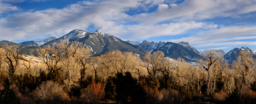
Absaroka Mountains
South Fork of Owl Creek
The South Fork of Owl Creek comes down off the Absaroka Mountains then flows east along the Owl Creek Mountains. It actually forms the northern boundary of the Wind River Reservation. It eventually joins the North Fork of Owl Creek to form Owl Creek. Owl Creek also forms the northern border of the Wind River Reservation for a time. Owl Creek empties into the Bighorn River around seven miles north of Thermopolis, Wyoming.
Rock Creek
Rock Creek is a tributary stream of the South Fork of Owl Creek. It empties into the South Fork of Owl Creek around 26 miles to the west of Embar Wyoming.
Cottonwood Creek
Cottonwood Creek comes down off the Absorokas and heads east, eventually joining the Bighorn River around 16 miles to the southwest of Worland, Wyoming.
Greybull River
The Greybull River rises in the Absorokas and travels around 90 miles to empty into the Bighorn River a mile to the south of Greybull Wyoming. A lot of the Greybull River runs through private property. Some prior research is in order here before planning an outing to the Greybull River.
Wood River
The Wood River is a major tributary of the Greybull River. It empties into the Greybull river approximately 6 miles to the southwest of Meeteetse, Wyoming.
Timber Creek
Timber Creek is a tributary stream of the Greybull River. It empties into the Greybull River around 14 miles to the southwest of Meeteetse, Wyoming. Rawhide Creek is a tributary stream of Timber Creek that also contains Yellowstone Cutthroat Trout.
East Fork of the Shoshone River
The East Fork of the Wind River is an approximately 30-mile-long tributary of the Wind River. It begins high in the Absorokas and joins the Wind River somewhere between Dubois and Crowheart, Wyoming.
Meeteetse Creek
Meeteetse Creek is a tributary stream of the Greybull River. It empties into the Greybull River approximately 3 miles to the north of Meeteetse, Wyoming.
South Fork of the Shoshone River
The South Fork of the Shoshone River has its beginnings high in the Absaroka Mountains. Eventually, it makes its way into Buffalo Bill Reservoir, which is around 8 miles to the Southwest of Cody, Wyoming. There is a road that follows the route of the river for around 40 miles. You will find private property interspersed with public land.
Dead Indian Creek
Dead Indian Creek, a tributary of the Clarks Fork River that is managed exclusively for Yellowstone Cutthroat Trout.
To get to dead Indian Creek, take Wy-120 north out of Cody until it changes into route 296 or the Chief Joseph Highway, then take the Chief Joseph Highway west towards Sunlight Basin. You will eventually cross Dead Indian Creek. At this point, turn right into Dead Indian Campground. The total distance from Cody, Wyoming, at this point, is 37.7 miles.
The Dead Indian Trailhead is 4 tenths of a mile to the south of the campground. The Dead Indian Trail goes north along the east side of Dead Indian Creek. It ends at Dead Indian Creek’s confluence with the Clarks Fork of the Yellowstone after 9.4 miles.
This is Bear country. Packing some bear spray is advised.
Upper Yellowstone River
A couple of different factors has hit the Yellowstone Cutthroat Trout population in the Yellowstone River drainage.
1-Whirling disease
Whirling disease is caused by a parasite. It causes skeletal deformation and neurological damage in trout. It was accidentally imported from Europe with some hatchery fish in the 1950s. Brown Trout originate from Germany and thus seem to have developed a genetic resistance to it. Our native trout have not encountered whirling disease through the generations and therefore are not as resistant to it as are Brown Trout. Whirling disease was first detected in fish from Yellowstone Lake in 1998.
2- Lake Trout in Yellowstone Lake
The illegal introduction of Lake trout into Yellowstone Lake in the 1980s has had a terrible impact on Yellowstone Cutthroat Trout numbers. The Lake Trout in the Lake feed on the Native Cutthroat trout. A mature lake trout can eat 40 cutthroat trout over the course of a year.
Efforts by park officials to remove Lake Trout from Yellowstone Lake are starting to pay dividends. Yellowstone Cutthroat Trout spawners that had been on the decline for years are on the increase.
The Following tributaries of the Yellowstone River hold Yellowstone Cutthroat Trout.
Thorofare Creek
Thorofare Creek is the largest tributary to the upper Yellowstone River. Its headwaters are to the southeast of the Yellowstone Park boundary in the Bridger Teton Wilderness. It gathers itself and flows northwest into the park, where it enters the Yellowstone River. Yellowstone Cutthroat Trout from Yellowstone Lake use Thorofare Creek and its headwaters to spawn.
The best time to find Yellowstone Cutthroat Trout in the Thorofare Creek drainage is from the first week in June to the middle of July. After that, most spawners from Yellowstone Lake will have migrated back downstream into the lake. The following are tributaries of Thorofare creek, Silvertip Creek, Open Creek, Pass Creek, Butte Creek, and Hidden Creek,
For a guided trip into the Thorofare area, try Hidden Creek Outfitters, 1710 North Fork Hwy, Cody, WY. (307) 899-1355
Atlantic Creek
Atlantic Creek gets its start In the Bridger Teton Wilderness in the form of North Two Ocean Creek. Two Ocean Creek runs right along the continental divide. At what is known as the parting of the waters, Two Ocean Creek divides into Pacific and Atlantic Creeks. Pacific Creek runs towards the Snake River and eventually the Pacific Ocean. While Atlantic Creek drains into the Yellowstone River and eventually the Atlantic Ocean at the Gulf of Mexico.
As with Thorofare Creek, the Yellowstone Cutthroat Trout fishery in this drainage has been adversely affected by the Lake Trout invasion in Yellowstone Lake but is on the rebound due to Yellowstone Park officials’ efforts to remove this invasive species.
For a guided trip into Atlantic Creek, try Swift Creek Outfitters – Teton Horseback Adventures, Pacific Creek Rd, Moran, WY 83013 (307) 856-1226
Other upper Yellowstone Tributaries
The following are some tributaries that enter the upper Yellowstone River within the boundaries of Yellowstone National Park. Please note that all Native trout are catch and release only within the confines of Yellowstone National Park. All of these streams hold Yellowstone Cutthroat Trout.
- Lynx Creek
- Phlox Creek
- Cabin Creek
- Trappers Creek
- Mountain Creek
- Cliff Creek
- Escarpment Creek
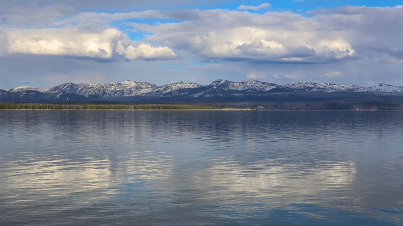
Yellowstone Lake
The following creeks drain directly into Yellowstone Lake and hold Yellowstone Cutthroat Trout; Trail Creek, Chipmunk Creek, Grouse Creek, Solution Creek, Big Thumb Creek, Little Thumb Creek, Arnica Creek, Weasel Creek, Bridge Creek, Pelican Creek, Sedge Creek, Cub Creek, Clear Creek, Meadow Creek, Columbine Creek, and Beaverdam Creek,
Lower Yellowstone River
In this post, I’m classifying any tributaries that enter the Yellowstone River after it leaves Yellowstone Lake as lower. The Yellowstone river fishery below the lake has been classified as more adversely affected by Whirling disease than has the upper portion.
As with the above paragraphs, the Yellowstone Cutthroat Trout holding streams that enter the lower Yellowstone River within the park’s boundaries are so numerous that unless there’s something otherwise remarkable about them, I’m only going to give them a generic mention here. They are; Thistle Creek, Elk Antler Creek, Trout Creek, Sour Creek, Alum Creek, Cascade Creek, Broad Creek, Deep Creek, Agate Creek, Antelope Creek, Elk Creek, Hellroaring Creek, Geode Creek, Little Buffalo Creek, and the Lamar River.
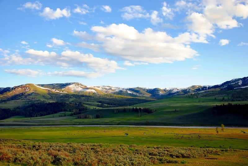
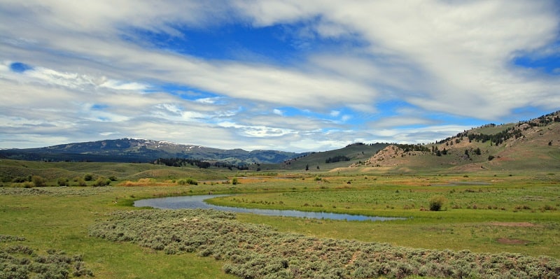
Lamar River
The Lamar River is an Approximately 40-mile-long tributary of the Yellowstone River that begins and terminates within Yellowstone National park’s confines. The Lamar River runs through the Lamar Valley, also known as America’s Serengeti, because of its large open meadows where it’s easy to spot large herds of Yellowstone parks herbivores and all the park’s predator species. Yellowstone Cutthroat Trout are the dominant fish species in the Lamar River, although it also holds some Rainbows. The easiest stretch of the river to access from where Soda Butte Creek joins the Lamar downstream for 5 or 6 miles also happens to hold the largest fish.
For a guided fishing trip on the Lamar River, try www.montanatroutonthefly.com/
Slough Creek
The Lamar river has several good tributaries, but the most famous one is Slough Creek. Slough Creek is world-famous for both the numbers and the size of its Yellowstone Cutthroat Trout. The Slough Creek campground and trailhead are around 8 miles from Tower Junction. Take the Northeast entrance road. For 5.8 miles and then turn right on Slough creek Road.
For a guided Slough Creek fishing adventure, try www.bearpawoutfittersmt.com/fly-fishing
West Slope of the Bighorn Mountains
The West Slope of the Bighorn Mountains Drains into the Bighorn River, which in turn drains to the Yellowstone River; thus, Yellowstone Cutthroat Trout is their native trout species. However, non-native fish have displaced Yellowstone Cutthroat trout over the majority of the Bighorn Mountains.
However, the following waters still hold Yellowstone Cutthroat Trout either due to geographic isolation or because of the Wyoming Game and Fish Department’s recovery efforts.
South Paint Rock Creek: Access to South Paint Rock Creek is 18.7 miles east of Hyattville Wyoming on Hyattville Logging Rd 117.
Dry Medicine Lodge Creek: Access to Dry Medicine Lodge Creek is around 29 miles from Shell Wyoming on Red Gulch Road.
Trapper Creek: Trapper Creek runs on the outskirts of Shell, Wyoming. I can’t really find a lot of information about this creek. I have been through Shell Wyoming, though, and it’s a beautiful area.
Trout Creek: On the northern end of the bighorns is Trout Creek. The following traveling directions are copied from the Wyoming Game and Fish Department’s website.
“Take Highway 14A east from Lovell or west from Burgess Junction. Turn north on Forest Rd 11, or the Sheep Mountain Road. After about 3 miles, there is a four-way intersection; turn right to stay on Forest Rd 11. This is a good gravel road for much of the way. Travel another 6.5 miles from the intersection past Duncum Mountain and the turnoff to Boyd Ridge down to a fork where you turn to the left, and the road becomes much rougher (the better road continues to the right, but that is Forest Rd 111). From this point, ATVs are recommended. Travel another 4 ¾ miles to the turnoff for Forest Rd 103 on the left. Take Forest Rd 103 for about 0.4 miles to a junction with Forest Rd 104 and keep right on 103. This road travels down into Cookstove Basin and terminates at the upper end of the instream flow segment.”
East Slope of the Big Horns
Little Tongue River
The Little Tongue River comes down off the Bighorn Mountains’ eastern slope and eventually joins the Tongue River at Dayton, Wyoming. The Little Tongue River’s upper reaches have been the subject of a recovery effort for Yellowstone Cutthroat Trout. This involved removing all non-native fish, followed by the reintroduction of Yellowstone Cutthroats to their native territory.
West Fork of the Little Bighorn
The West Fork of the Little Bighorn River comes down Off the eastern slopes of the Bighorn Mountains and begins at Mann and Pumpkin Creeks’ confluence. I can’t find much extra information on this water other than it is listed as having Yellowstone Cutthroat Trout.
Lodge Grass Creek
Lodge Grass Creek is another east slope of the Bighorn Mountains stream that has Yellowstone Cutthroat Trout. The following directions to get there are copied from the Wyoming Game and Fish Department’s website.
“Take Highway 14A east from Lovell or west from Burgess Junction. Turn north on Forest Rd 11, or the Sheep Mountain Road. After about 3 miles, there is a four-way intersection; turn right to stay on Forest Rd 11. This is a good gravel road for much of the way. Travel another 6.5 miles from the intersection past Duncum Mountain and the turnoff to Boyd Ridge down to a fork where you turn to the left, and the road becomes much rougher (the better road continues to the right, but that is Forest Rd 111). From this point, ATVs are recommended. Travel another 5 miles, just past the turnoff for Forest Rd 103 to Forest Rd 101. Take Forest Rd 101 for about 0.75 miles down to an area near the cow camp. Park here and hike 1 mile down to the instream flow segment.”
Enjoy the Adventure
I’m sure I’ve missed a few, but I’ve endeavored to touch upon as many Yellowstone Cutthroat Trout waters within the state of Wyoming as I could. It’s a cinch that there are some places in there you’ve never been to before.
If you complete the Cut-Slam, you are guaranteed some great memories and some adventure.
Recent Articles
The least weasel is the world's smallest carnivore. This little predator is also the smallest member of the Mustelidae or weasel family. They are around 320 times smaller than wolverines,...
The only venomous snakes in Washington State are Northern Pacific Rattlesnakes. The Northern Pacific Rattlesnake (Crotalus oreganus oreganus) is a sub-species of the Western Rattlesnake. Anyone...