Andrew Miller, Andrew Miller Studio ©
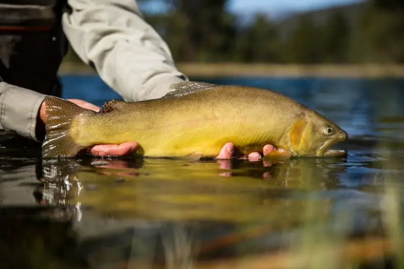
Gila Trout are extremely rare. Even in times pre European American civilization, they never were overly plentiful or widespread. They’re even less so today. Even though they’re rare, there are places in New Mexico and Arizona where you can legally fish for Gila Trout. This article will tell you where
Historically, areas where they were known to exist, are higher elevation streams in portions of the Gila River drainage in New Mexico, San Francisco River drainage in Arizona and New Mexico, and tributaries to the Gila River in Arizona. Since its first discovery, it has been pushed to the brink of extinction and federally listed as an endangered species. It was brought back from the brink so that limited fishing is allowed for this magnificent fish. According to New Mexico’s 2020 fishing regulations, the following waters are open to fishing for Gila Trout.
- Mogollon Creek from waterfall to Trail Canyon
- Willow Creek
- Gilita Creek
- Black Canyon Creek
- Whitewater Creek (Catwalk section)
- Gwynn Tank
- Lake Roberts
- Mineral Creek
- Sapillo Creek
- Gila River Forks Area
- West Fork Gila River from headwaters to Ring Canyon
According to the Arizona Game and Fish Department’s website, there are no Arizona waters open to fishing for Gila Trout in 2020.
New Mexico Gila Trout Regulations
Mogollon Creek- Open to fishing July 1st through October 1st. This is a catch and release only stream. Anglers can only use artificial lures with single hooks.
Willow Creek- There is a two Gila Trout limit. There is no limit on Brown Trout.
Gilita Creek– Again, there is a two-fish limit on Gila Trout. There is no limit on Brown Trout.
Black Canyon Creek- Above the fish barrier, the season runs July 1st through October 1st.
Fishing is catch and release only. Anglers may only use artificial lures with single hooks. This area was hit hard by the “Silver Fire” subsequent flooding that inundated the creek with silt and ash in 2013, but per a 2018 survey, habitat and fish populations are recovering nicely.
- Below the fish barrier in Black Canyon, there is a 5 trout limit.
- West Fork Gila River from headwaters to Ring Canyon- There is a five trout limit. Gila Brown and Rainbow Trout are all found in this section of the River.
- Cat Walk section of Whitewater Creek- 2 Trout Limit
- Sapillo Creek- 5 Trout limit. Sapillo Creek is stocked with Gila Trout from November through April.
- Mineral Creek- 2 Trout limit.
- Gwynn Tank- 5 Trout limit.
- Lake Roberts- 5 Trout Limit

Getting There
Mogollon Creek
Mogollon Creek is a tributary of the Gila River located in the Gila Wilderness in the Wilderness Ranger District.
To get there, travel approximately 30 miles northwest from Silver City, NM, on State Highway 180 West to Cliff, NM. There are gas and camping supplies available there.
From Cliff, travel northeast on State Road 211 for approximately 2.25 miles to 916 Ranch Road.
Head North on 916 Ranch Road for about 7 miles to an intersection, take a right, and head east for approximately 6.5 miles to the “74 Mountain” trailhead, where there is a parking lot and trailhead sign.
Bring water
Plan on packing enough water for around seven miles of hot weather hiking. As far as I can ascertain, there is no water along the trail between the parking lot and Mogollon Creek.
Bring Rain Gear
Also, keep in mind that July and August are the height of the monsoon season in New Mexico. Go prepared with a rain poncho and keep an eye turned to the sky. Remember, it’s never a good idea to find yourself out on a high point or in an area where you are at the highest point during a thunderstorm.
Black Canyon Creek
From Silver City, take State Hwy. 180 E 6 mi. to NM-152 at the town of Central “also known as Santa Clara.” From there, Turn right onto NM-152 and after 15 miles, turn east, onto state road 35, and continue for approximately 17 miles in a northwest direction to Forest Road 150, also known as NorthStar Mesa Rd. Turn right on Forest Road 150 and continue for 18 miles to Black Canyon.
It sounds like this isn’t a trip to take in the family van. For the best chance of success in not getting stranded, make this trip in a high clearance four-wheel-drive vehicle.
Those seeking more information about these directions, road conditions, and other information about
Willow Creek
From Reserve New Mexico, take route 435 southeast, approximately 40 miles to Willow Creek campground.
Drive 4 miles north of Glenwood on US 180 or 1 ½ miles south of Alma. Turn east on New Mexico 159 “Also known as the Bursom road.” toward Mogollon. Route 159 will change from pavement to improved gravel after 9 miles. Keep going 27 miles east to Gilita Creek Campground.
West Fork Gila River from headwaters to Ring Canyon
The closest town to the West Fork of the Gila River Trailhead is Mimbres, NM.
The following is copied from the United States Forest Service website:
“Trail 151 is relatively impassable from Willow Creek Trailhead to White Creek Cabin. White Creek Cabin southeast to Big Bear #28 has been worked, but some sections may be challenging or obstructed.
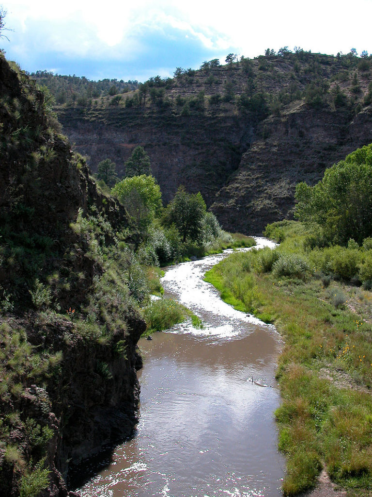
Trail 151 is one of the hallmark trails of the Gila Wilderness. It follows the West Fork of the Gila River through a beautiful, deep, winding canyon with spectacular volcanic cliff formations.
River Crossings
There are many river crossings per mile, and boots that can be worn for wading are recommended. Many trails can be connected to cross the Gila Wilderness, but #151 is one of only two trails that completely traverses the wilderness. The southern trailhead is at the Gila Cliff Dwellings, and the northern trailhead is at Willow Creek. The trails that connect with #151 can be linked to make several very interesting loops through the wilderness’s interior. These loops provide opportunities for extended pack trips in quiet solitude and a wonderful variety of scenic canyon, mesa, and mountain terrain.”
Cat Walk section of Whitewater Creek
In the town of Glenwood, NM. look for signs indicating the direction to New Mexico 174. Take route 174 around 5 miles to the Whitewater picnic ground. Upstream Whitewater Creek flows through a narrow rocky gorge. In places, the trail is suspended in the air by a series of narrow catwalks attached to the canyon walls.
Sapillo Creek is actually the inlet stream to Lake Roberts Take NM. Route 15 28.7 north from Silver City.
From Silver City, New Mexico, take U.S route 180 65.7 miles northwest to the historic small community of Alma, New Mexico. From Alma, take Mineral Creek road 7 ½ miles to the Mineral Creek trailhead.
From Reserve, New Mexico, take Beaverhead road 33.7 miles to Gwynn Tank.
From the U.S Forest Service website, “Lake Roberts is located in the Wilderness Ranger District along NM 35. You can gain access via NM 35 or NM 15. NM 15 is a narrow paved, winding road that may not be suitable for trucks with trailers.”
From Silver City, New Mexico, take N.M route 15 30 miles north, then turn east on N.M route 35 to Lake Roberts.
From Mimbres, take N.M route 35 19.2 miles to Lake Roberts.
the Gila wilderness and forest areas can visit the Gila National Forest’s website or call their office in Silver City at (505) 388-8201
Arizona Gila Trout
Recovery Streams
There is an ongoing effort to restore Gila Trout to its native range in Arizona. The AZGFD has set aside six recovery streams across the Agua Fria River, Blue River, lower Gila River, and Verde River drainages for Gila Trout recovery. Fishing isn’t allowed in these recovery streams at present.
Places You Can Fish For Gila Trout In Arizona
There are, however, places in the state where angling for Gila Trout is allowed. They are as follows.
The East Verde River
The AZFGD stocks the East Verde River with Gila Trout weekly during the summer. See https://www.azutopia.com/easy-hikes/water-wheel-hiking-trail-to-ellison-falls/ and https://www.fs.usda.gov/recarea/tonto/recarea/?recid=35587.
Frye Mesa Reservoir
Frye Mesa Reservoir is about ten miles out of Safford, Arizona. It features both Apache and Gila Trout.
See https://www.fs.usda.gov/recarea/coronado/recarea/?recid=25452
It’ll take you awhile to fish all the waters listed in this article.
You won’t be wasting time, though. Any time spent in the outdoors exploring new places is time well spent.
There’s a new interest in fishing for native trout in their home environment. That’s a good thing. If more people become informed and enthusiastic about these fish, they’re less likely to become extinct due to their obscurity.
Arizona and New Mexico both run trout challenges. Click the links below for more information.
Good luck and good fishing.
Arizona Trout Challenge New Mexico Trout Challenge
Arizona State Fishing Records New Mexico Fishing Records
Recent Posts
The only venomous snakes in Washington State are Northern Pacific Rattlesnakes. The Northern Pacific Rattlesnake (Crotalus oreganus oreganus) is a sub-species of the Western Rattlesnake. Anyone...
Skunks are not classified as true hibernators. But they go into a state of torpor when the weather gets cold. Skunks are light sleep hibernators, along with opossums, bears, and raccoons. ...

