California is a large state with lots of people and things to do. Attractions like the Hollywood sign may be the first things many imagine when they think of Southern California, but it’s also a region that’s home to some of the best hikes in the world. It’s a place filled with panoramic views of towering mountains and sparkling coastlines. There’s something here to appeal to every kind of hiker, whether you’re looking for an easy hike or a great place to explore the highest peak.
Best Time to Hike in Southern California
We are going to talk about a lot of trails here in a moment, but real quick, let’s talk about when to go hiking in Southern California. Most people who live in the Northern Hemisphere imagine the summer months are the best time for hiking. If you are in Northern California, especially along the coastline, that’s true. Humboldt County is best explored in July and August.
Down south, the summer months are hot, and dry, and will require extra forethought when it comes to hydration.
In Southern California, the best time for hiking is in late spring. You want to plan your biggest hikes in late March through May. Autumn can also be a good time, so plan for late September through November.
If you’re hiking in the summer months, do plan ahead for how you’ll handle the heat. Think about hats, sunscreen, and hydration, hydration, hydration.
Be aware that if you’re not from the area and aren’t used to hiking in these conditions, dehydration and sun sickness can sneak up on you. You may not realize you’re falling ill, and then become disoriented while out and on a trail. This is a serious danger that can lead to wandering off trail and getting lost.

Hiking Trails on Catalina Island
Catalina Island is a picturesque paradise located just off the coast of Southern California. Known for its crystal-clear waters, rugged coastline, and stunning views, the island is a popular destination for hiking enthusiasts.
Hermit Gulch Trail is a six-mile loop. It’s considered a moderate trail. There are 1,509 feet of elevation gain here. You will be hiking through an absolutely stunning canyon, sometimes with views of the island’s rugged coastline, and sometimes with views of the town of Avalon. In the spring, you may be seeing a canyon full of beautiful wildflowers.
Hermit Gulch does start off right away with a steady incline, so you’ll realize what you’re getting into pretty fast. Be aware that there is very little shade available on this entire trail. It’s good to go on a clear day though, if you want to get the best views.
Garden to Sky Trail is just three miles long with 781 feet of elevation gain. It is an out-and-back trail. Dogs are not allowed. It is considered to be fairly difficult. You’ll get a greater feel for the island’s interior on this trail. You’ll get a great view once you get to the top.
Trans-Catalina Trail is the island’s long-distance trail. It is a 37-mile point-to-point trail with over 7,900 feet of elevation gain. This is for the people who really want to go all in. You’ll explore the island’s interior, you’ll get stunning views of the Pacific Ocean, and you’ll go through different ecosystems. You can see oak woodlands, coastal scrub, and grasslands along the way.
Cell phone service is spotty on this trail, so you’ll need to bring printed maps and write down what campgrounds you’ve booked your stay at. It may be hot during the day but chilly at night with the breeze off the Pacific Ocean, so plan for that with the gear you bring.
There are more trails on the island. In general, this is just a great place for walking around. These three–Hermit Gulch, Garden to Sky, and Trans-Catalina–are some of the main options that cover what you’re likely to experience here. No matter which hikes you choose on Catalina Island, you’re sure to be treated to stunning views, unique wildlife, and a true escape from the hustle and bustle of everyday life. With its rugged terrain, crystal-clear waters, and unique flora and fauna, Catalina Island is a nature lover’s paradise.

Hiking in Malibu Creek State Park
Malibu Creek State Park is a true gem of Southern California, located just a short drive from the bustling city of Los Angeles. Known for its stunning views, rolling hills, and diverse wildlife, the park is a popular destination for hiking enthusiasts.
Malibu Lake Trail is a six-and-a-half-mile, out-and-back trail. It has an elevation gain of 400 feet. It’s located near Calabasas. This is a beautiful trail along the creek, but carries one big danger visitors need to be aware of: snakes. Specifically, rattlesnakes. Wear tall boots that cover your ankles, and always stay aware of your surroundings. With that warning out of the way, this is one of the most popular trails in Malibu Creek State Park for a good reason. You’ll hike through a beautiful canyon with lush vegetation, sparkling water, and lovely hills and rock formations.
If you can time this hike when wildflowers are in bloom, do so. This trail is great for seeing fields of wildflowers. This trail is one of the rare opportunities to hike in a canyon without a lot of elevation gain, so it’s a fairly easy walk, though somewhat lengthy for some people. Note that this trail does not allow dogs. The concerns about rattlesnakes may be part of the reason for that.
Rock Pool and Century Lake Trail is a four-and-a-half-mile loop with only 331 feet of elevation gain. Fans of the television program M*A*S*H come out here to see the iconic set used to film the TV show in the 1970s. Fans of Planet of the Apes come out here to see where the movie was filmed. There is a rock wall in the movie that rock climbers come out to scale today. Between the picturesque trail itself, the TV show fans, and the movie fans, this is definitely a popular spot.
There is a bridge on the trail to get to the M*A*S*H set, and sometimes that bridge is out, so if that is specifically what you’re hiking out to see, you may want to check online to see if anyone has reported whether the bridge is currently up. In general, in the rainy season, parts of the trail may be washed out.
With that bit in mind, this is a truly spectacular hike. It’s an easy enough hike with a lot of variety in it, and it’s a loop, so you don’t have to see the same things twice. There is a pool with walls of volcanic rock. A large portion of the hike takes you down an oak-shaded walkway. The lake is definitely worthy of social media posts. If you’re up for it, bring a picnic to enjoy by the lake.
Malibu Creek State Park is clearly a great spot for hiking in Southern California. There are more trails than this, but these two are the big ones to consider for a day of stunning views, rolling hills, sparkling streams, rock formations, stunning lakes, and wildlife. Clearly, there is a lot to see. You can’t go wrong with a day of hiking in this state park.

Best Hiking Trails in Crystal Cove State Park in Southern California
Crystal Cove State Park is a beautiful coastal park located in Orange County, California. With over 2,400 acres of pristine wilderness, the park offers some of the most beautiful hiking trails in Southern California. The park includes 3.2 miles of coastline. There is a historic district of beach houses.
Note that at the time of writing this article, El Moro Canyon Trail is currently closed, and it is unclear when that trail will reopen. It’s closed due to unsafe conditions. Severe rains have caused mudslides, so there is no way in or out of this area. This happens in the springtime in California and may be a recurring issue.
This is probably the best/most popular hiking trail in Crystal Cove State Park (and one of the most popular in Southern California in general). If it’s open, it is recommended that you check this beautiful trail out. The trail is a loop, five miles long, and has 800 feet of elevation gain. It includes beach access. It is a moderate to difficult trail. You’ll want to check in with the ranger station to be sure it’s open before heading out.
Reef Point and Crystal Cover Trail is a 5-mile loop near Laguna Beach. It is an easier route, very popular, and a great chance to see the beach. This trail is actually best in June through November. The summer months are a bit warmer and kinder with the wind coming off the Pacific Ocean.
When near the beach, look for the cliffs. On the cliffs and on the walls, you’ll see seashell fossils embedded in the sandstone. This is a mesmerizing and awe-inspiring site.
Crystal Cove State Park is one of the best places to get views of the Southern California coastline. There are fossils to be seen, great loop hikes, and spots with higher elevations to give you panoramic views. Check with your ranger station to see what trails are available, and head out for big views on this one.

Trails in the San Gorgonio Wilderness
The San Gorgonio Wilderness is a stunning area near Palm Springs, California. It offers breathtaking hiking trails with rugged terrain for hikers who want a rewarding and challenging experience.
The Vivian Creek Trail is one of the most popular options. It is 19 miles long and has an elevation gain of 5,492 feet. And, it’s an out-and-back trail. This one definitely isn’t an easy hike. This is a good hike for someone wanting to camp along the way who wants to see the highest point in Southern California. It will take hikers up to the peak of San Gorgonio Mountain.
This trail is best in the warmer months. In the winter, there are icy areas that are quite dangerous. People do go hike this with an ice pick, but that’s not recommended. The snow melt can get dangerous. The best time is usually April through October, but check local conditions at the time you intend to tackle this peak.
This trail goes through dense forests, rocky terrain, and several sets of touch switchbacks. The challenging and long hike provides hikers with sights like waterfalls, creekbeds, and stunning panoramic views of the surrounding mountains.
Another popular trail is the South Fork Trail, which follows the South Fork of the Santa Ana River and leads hikers to Dry Lake. This is another fairly long trail at around 12 miles. It’s also an out-and-back trail with 2,250 feet of elevation gain. This is another challenging trail. In the winter, you’ll see people cross-country skiing on this one. You’ll often need snowshoes in the wintertime as well.
This is one of the most popular options for hiking in Southern California in the snow. You’ll get great views of the surrounding mountains, wide open spaces, and room for safely traversing the snow even with the elevation gain. The elevation gain on this one is more gradual than what you’ll find on Vivian Creek. Once you reach Dry Lake, you’ll be rewarded with breathtaking views of the San Gorgonio Wilderness.

San Jacinto Peak Near Palm Springs
The best trail to get to the San Jacinto Peak is from the Tramway. There is a tram parking lot where you can park (for a fee), and then you can take the tram up to the ranger station, where you’ll need to get a permit.
Then you’ll be doing an approximately 10-mile out-and-back hike. There are 2,555 feet of elevation gain. It’s a fairly difficult trail, and more difficult if you decide to do it in the winter.
In the winter, you will need crampons and snowshoes to do this hike. If you’re going to camp, know that it gets very windy and brutally cold up there at night.
You should also bring a headlamp because it gets darker earlier, and the trail can be difficult to see on the way back.
Hiking to the top will give you stunning views of the surrounding mountains, a lot of time in pine forests, and views of jagged rock formations on the mountainsides.

Hiking in Joshua Tree National Park
Joshua Tree National Park is a must-visit destination for any nature lover or outdoor enthusiast. There’s a reason so many songs have been written about this place, U2 was such a fan, and so many movies are filmed here. It’s one of the more inspiring National Parks you’ll ever visit.
This breathtaking park, located in Southern California, offers a unique blend of stunning rock formations, sweeping desert landscapes, and diverse wildlife. But perhaps one of the park’s most popular attractions is its extensive network of hiking trails.
For the most part, since this is the desert, you’re going to want to hike in Joshua Tree in the colder months. Plan your trip for October through May if possible. It gets very hot and very dangerous in July.
Ryan Mountain Trail is a moderately challenging out-and-back trail. It’s three miles long with a little over a thousand feet of elevation gain. Hiking to the top will get you panoramic views of the entire park. And because this is sunny, desert Southern California, most days are going to give you clear views.
Barker Dam Trail is a nice easy hike that can be very rewarding. This one is a loop, slightly over one mile long, and with only 59 feet of elevation gain. And yet, it’s one of the best ones to do in the park. While this trail can be done in under 30 minutes, you’re going to see stunning rock formations, and desert plants, including the Joshua Trees. You’ll see cactus, creeks, lizards, and in the spring months, desert flowers. And, as the trail name indicates, you’ll see a small dam. You can also spot petroglyphs on the rocks left by Native Americans who used to live in the area. Whether you’re a regular hiker, someone looking for a short hike, or trying to find an easy hike with kids, Barker Dam Trail is a must-see. This isn’t just an easy hike, it’s a stunner that no one should miss.
Hidden Valley Trail is another one of the best short and easy hikes you’ll find in Southern California. This one is a mile-long loop with 118 feet of elevation gain. It sounds strange to say that you can’t miss this one because you need to see the rocks, but you do. This trail is going to take you through a boulder-strewn valley surrounded by towering rock formations. You’ll feel like you’ve entered another world. This is especially true if you don’t live in the desert, but even people who’ve lived in the desert will admit this trail is fairly spectacular. This valley was once used by cattle rustlers, who hid their stolen herds here. This is the story the name of the trail is eluding to. Now, it’s a popular spot for rock climbers and hikers.
No matter which trail you choose to explore, hiking in Joshua Tree National Park is an unforgettable experience. Seriously, don’t skip Joshua Tree. You’ve probably heard about it a lot, so may wonder if it’s overhyped. It’s not. It’s a shame that it sometimes overshadows some of the other unique hiking spots in the region, but that in no way indicates that Joshua Tree isn’t worth the hype. It is. Hike up your lacing boots, bring lots of water, and enjoy even a few short walks in this one.

by Sergei Gussev
San Clemente Beach Trail
San Clemente is a picturesque beach town in Southern California, located between Los Angeles and San Diego. Its beautiful beaches, charming downtown area, and scenic hiking trails make it a popular destination for both locals and tourists alike.
The San Clemente Beach Trail is a 2.3-mile, one-way trail. Out and back, you’re looking at closer to five miles. It starts at North Beach and ends at Calafia Beach. Calafia Beach is a real gem and definitely worth seeing. The trail itself is often boardwalk or sand. This is a light hike that’s popular with joggers.
This is an easy trail, but worth talking about because it follows the coastline. It’s a great way to see the different beaches and stretches of coastline in the area. You’ll be seeing the pier, streets in town, and the Pacific Ocean while you walk. You’ll need to pay for parking by the hour at either end of this trail. Currently, the price is $1.50 an hour for using the parking lot.
One of the best times to hike the San Clemente Beach Trail is during sunrise or sunset. The trail offers stunning views of the sun setting over the ocean, making for a breathtaking and memorable experience. Hiking during these times also allows for cooler temperatures and fewer crowds, allowing hikers to enjoy the trail at their own pace.

Solstice Canyon Trail
This three-mile loop is nestled in the Santa Monica Mountains, outside of Malibu. It’s located just a little ways off the Pacific Coast Highway. The trail has 669 feet of elevation gain and is considered to be a moderately challenging trail.
Solstice Canyon Trail is a hidden gem that offers a unique hiking experience for both locals and tourists. This trail takes hikers through a beautiful canyon filled with lush vegetation, sparkling streams, and historic ruins.
The trail starts at the Solstice Canyon parking lot, where hikers can pick up a map and learn about the area’s history at the visitor center. You’ll want to arrive early, probably before 9:00 am on the weekends, because the parking lot gets packed. From there, the trail leads hikers through a shady grove of oak and sycamore trees. In the spring, you have a great chance of seeing a great deal of wildflowers.
One of the most unique features of this trail is the Solstice Canyon waterfall. The waterfall is a picturesque cascade that drops into a tranquil pool below. Hikers can take a break from their hike to relax by the waterfall and enjoy the scenery. The pool also offers a refreshing swim on a hot day. The waterfall is located near the ruins of the Roberts Ranch House, also called Tropical Terrace.
This dream vacation home was built in the later 1970s by Fred and Florence Roberts. Fred, unfortunately, passed away before the design was finished. Today, the ruins of the home remain, and hikers come to explore it and take photographs. It’s also a great spot to get views of the canyon.
One of the best times to hike Solstice Canyon Trail is during the spring when the wildflowers are in bloom. The hillsides are covered in a colorful blanket of wildflowers, making for a truly breathtaking experience.
With ruins, waterfalls, and wildflowers, Solstice Canyon Trail is a great spot to add to your list of Southern California hikes you don’t want to miss.

The Pacific Crest Trail in Southern California
The Pacific Crest Trail (PCT) goes through all of California up through Oregon and into Washington state. It travels through the Sierra Nevada and Cascade Mountains. Some of its best spots are in Northern California and Oregon.
That being said if you’re just going to pick a reasonable hike here to see in the Southern California portion of the trail, consider checking out Mount Laguna and Foster Point.
The Pacific Crest to Mount Laguna and Foster Point trail is an out-and-back experience of six miles. There are 666 feet of elevation gain. It’s a moderate trail. It doesn’t get extremely steep, the incline is more gradual.
For your efforts, you’ll get a panoramic view of the desert below, as well as the two highest peaks in Southern California: San Jacinto and San Gorgonio. The view of the desert is really what this one is all about.

Mount Baldy in San Bernardino County
Check out, Mount Baldy. This is the iconic mountain peak in the San Gabriel Mountains. There are easy and difficult hikes here. For a ten-mile out-and-back trail with 1,246 feet of elevation gain, check out the Bridge to Nowhere via East Fork Trail. If you do this, though, always respect the river. Do not underestimate how fast and strong the river is. It is also a lot deeper than you might expect. Check the conditions on the trail before you hike.

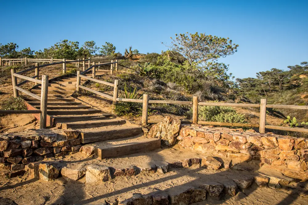
Torrey Pines State Reserve Near San Diego
Torrey Pines State Reserve is a coastal park near San Diego and is home to some of the most beautiful hiking trails in Southern California.
The Torrey Pines Beach Trail is one you won’t want to miss. This one is fairly easy at only just over two miles, with 364 feet of elevation gain, and it’s a nice loop. However, you need to make sure you park near the top near the visitor center. Otherwise, you will need to hike up a steep climb to get to the actual trail.
If you can, plan for a sunny day for this hike. Your views will be a lot better. It’s pretty when there is fog or rain, but it’s so much better when you can see all the way out to the horizon.
You’re going to be rewarded for taking this short hike with unique views of the cliffs along the coastline. For half the hike, you’ll be right along the water. Then you’ll get more inland and get a better sense of this unique terrain. In the spring, you can also expect wildflowers and a lot of lizards and beach life to look at. Because the terrain changes a fair amount in only a two-mile loop, this one is very entertaining and satisfying.
Hiking in Southern California
No matter which hikes you choose in Southern California, you’re sure to be treated to stunning views, unique wildlife, and a true escape from the hustle and bustle of everyday life. With its towering mountains, sparkling coastlines, and diverse wildlife, Southern California is truly a nature lover’s paradise. By exploring more of the state and National Parks, you’ll get some of the best views you’ll find in your life.
